4 things to know about the weather:
- Weather alert: terrible air quality
- Still hot but less humid
- Plan for a stormy Saturday PM
- Cooler next week
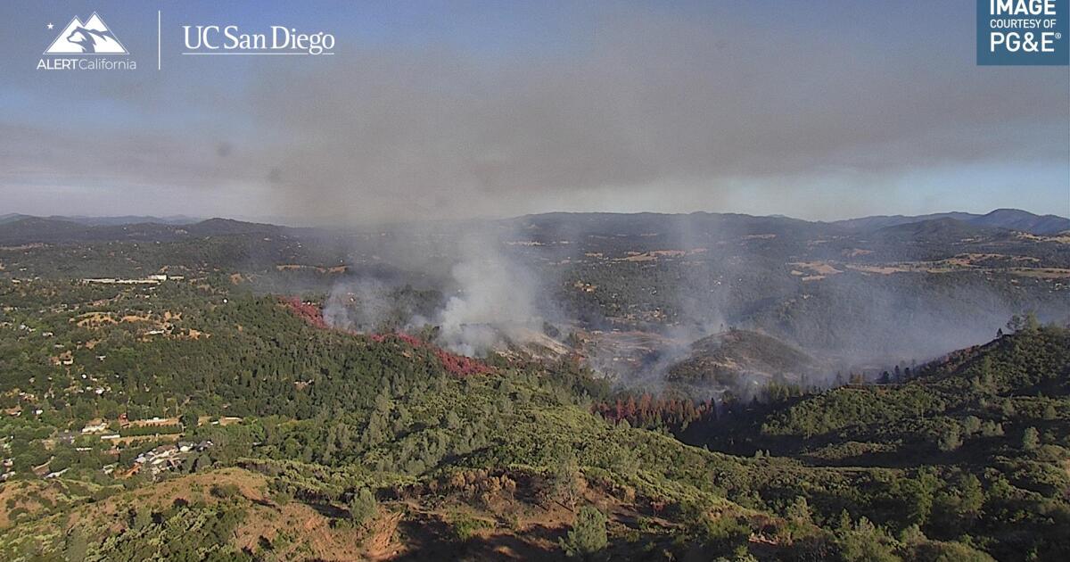
The instant you step outside, you’ll see it and smell it. Thick smoke from Canadian wildfires has moved into the region and will leave the Washington, D.C., area with absolutely terrible air quality for the rest of Friday.
Code red air quality alert means that anyone with underlying heart and lung issues should avoid going outside at all. Thick smoke particulates are likely to cause eye and nose irritations for even the healthiest people, so outdoor time should be limited as much as possible or practical.
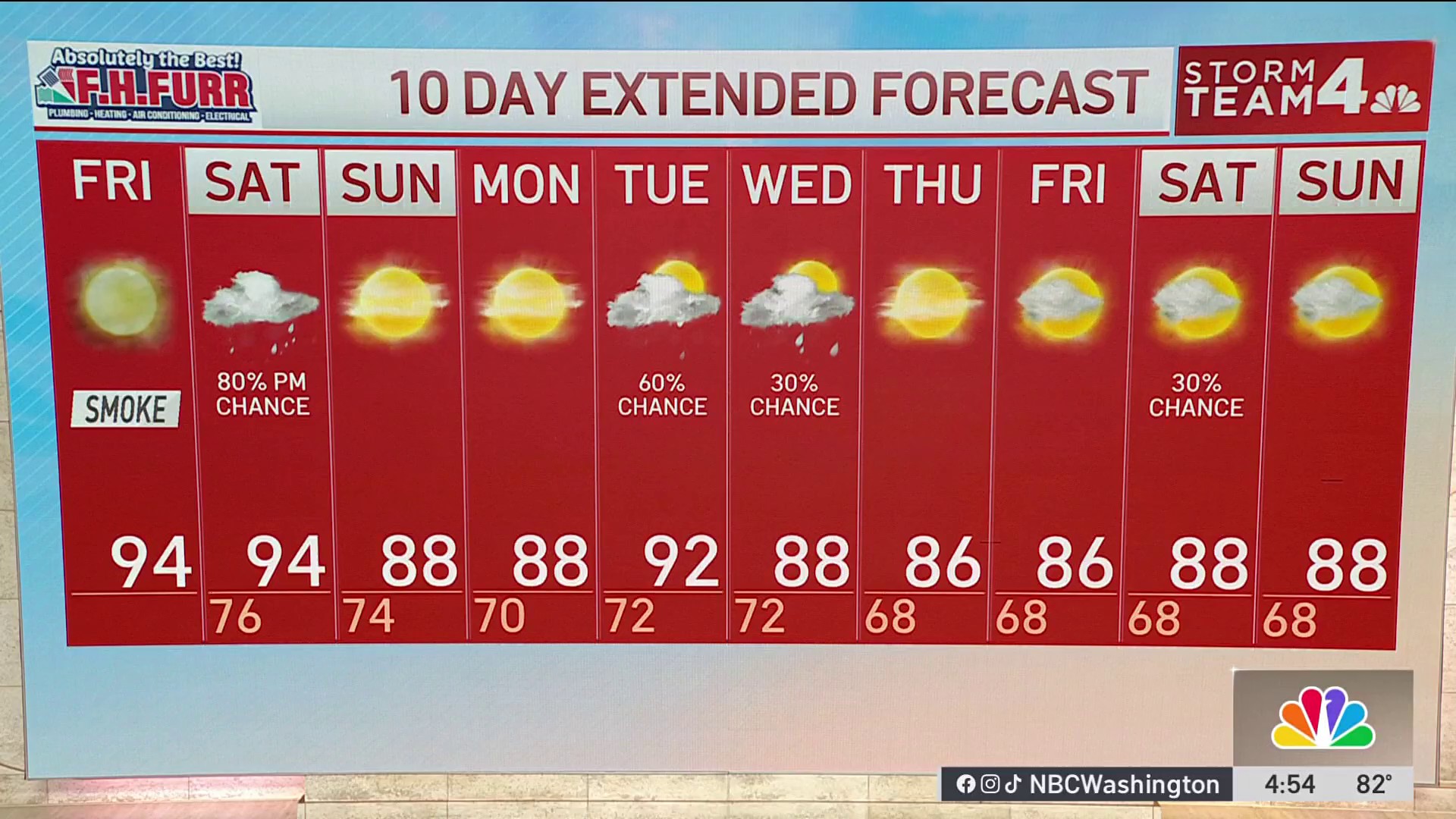
Outside of the smoke, Friday will be a bit cooler and quite a bit less humid than Thursday. Highs will climb into the low 90s.
Not that you’ll be able to see them through the smoke, but clouds will increase Friday night as a cold front approaches from the west.
Expect more humidity and storms Saturday
We’ll stay dry Friday night, but it will be very mild and muggy by Saturday morning. Southwest winds will increase Saturday ahead of developing thunderstorms. That change in wind direction will improve the air quality but bring high humidity along with it.
Highs will get back into the low-90s with a heat index topping 100° before storms finally arrive.
Locally strong to severe storms will be capable of producing very heavy rain and the risk of urban and flash flooding. Rain chances will remain low for the morning hours, but all bets are off after 2-3 p.m. and storms will be widespread from 4- 5 p.m. onward.
Storms will linger into late Saturday night before tapering off around sunrise Sunday morning. Sunday afternoon and Monday will turn out to be quite nice, followed by a humid and stormy Tuesday.
Weather radar
Download the NBC Washington app on iOS and Android to check the weather radar on the go.
10-day forecast
QuickCast
TODAY:
Thick wildfire smoke
Not as hot or humid
Very little breeze
Wind: variable 5 mph
Chance of rain: 0%
HIGHS: 90° to 95°
TONIGHT:
Thick smoke remains
Increasing clouds
Turning much more humid
Wind: south 5 mph
Chance of rain: 0%
LOWS: 70° to 76°
SATURDAY:
Mostly cloudy, very humid
Heat index over 100°
PM: Heavy rain/thunder likely
Wind: southwest 10-20 mph
Chance of rain: 90%
HIGHS: 87° to 93°
SUNDAY:
AM cloudiness
Becoming mostly sunny
Turning less humid
Wind: northwest 5-15 mph
Chance of rain: 20% (early)
HIGHS: 84° to 89°
MONDAY:
Sun and clouds
Cooler than average
Not too humid
Wind: southeast 5-10 mph
Chance of rain: 20%
HIGHS: 84° to 89°
Sunrise: 5:57 Sunset: 8:31
Average High: 90° Average Low: 73°