4 things to know about the weather:
- Cool Saturday morning
- Humidity increases Saturday afternoon
- Rain back Saturday overnight into Sunday
- Rain chances Sunday through Thursday, breezy
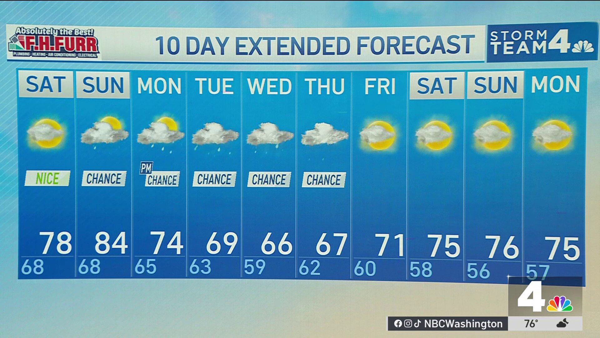
Cloud cover will remain fairly thick over the next few days, so even though rain isn’t really in the forecast, sunshine will be at a premium all the way through the weekend, and through most of next week, too.
Saturday looks to be the best day for outdoor activities, and there will be some sun at times.
Saturday afternoon will be comfortable, with highs remaining in the mid-to-upper 70s.
Download the NBC Washington app on iOS and Android to check the weather radar on the go.
Highs on Sunday will climb back into the 80s with increasing humidity. Rain showers are expected to return Sunday, beginning a long stretch of unsettled weather.
Monday looks cloudy with scattered showers and highs in the low 70s. Steadier rain now looks likely from Tuesday through Thursday with upwards of 1.5 to 2 inches possible by the time all is said and done. This will be a cool, autumn rain, too, with highs remaining in the mid 60s. This will be good news for our long-term drought situation.
QuickCast
SATURDAY:
More clouds than sun
Remaining dry
Lower humidity
Wind: northeast/east 5-10 mph
Chance of rain: 0%
HIGHS: 75° to 80°
SUNDAY:
Warmer & more humid
Mostly cloudy
Scattered showers
Wind: south 10-20+ mph
Chance of rain: 60%
HIGHS: 80° to 86°
MONDAY:
Cloudy and cooler
A few showers likely
Wind: northeast 10 mph
Chance of rain: 60%
HIGHS: 70° to 75°
TUESDAY:
Cloudy, breezy
Rounds of showers likely
Wind: NE 10-20+
Chance of rain: 60%
HIGHS: 60s
Sunrise: 6:53 a.m. // Sunset: 7:10 p.m.
Average high: 80° // Average low: 63°