4 things to know about the weather:
- Warm and summer-like Thursday
- Limited storm risk through Friday
- Slight cooldown Friday
- Pleasant start to the weekend
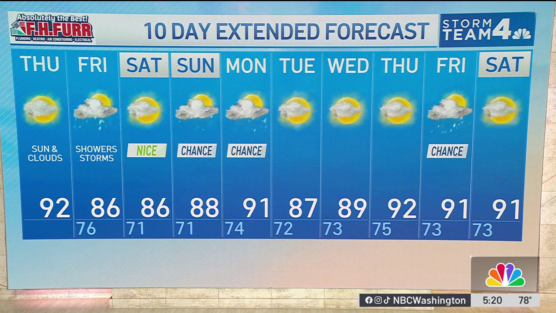
Expect sun to mix with some clouds across D.C. and the surrounding Maryland and Northern Virginia suburbs Thursday. Afternoon temperatures will climb into the lower 90s with moderate humidity.
Most neighborhoods stay dry Thursday, but showers and/or thunderstorms will develop Friday. Any storm could briefly produce heavy rain and lightning.
Temperatures ease back into the mid- and upper 80s Friday as clouds increase. Humidity remains noticeable.
Saturday looks to be the pick of the next few days with a mix of sun and clouds, nice temperatures, and only a very low risk of a shower.
Weather radar
Download the NBC Washington app on iOS and Android to check the weather radar on the go.
QuickCast
Thursday
Mostly sunny, warm, and somewhat humid
Pleasant start with sunshine dominating
A few fair-weather clouds during the afternoon
Dry for most of the region
Wind: Northwest 5 to 10 mph
High Temperature: 89°-92°
Thursday night
Partly cloudy and mild
Comfortable overnight conditions
Patchy clouds late
Low Temperature: 71°-75°
Friday
Partly sunny and slightly cooler
Showers and/or thunderstorms possible
Any storm may bring brief downpours
Wind: North to Northeast 5 to 10 mph
High Temperature: 85°-88°
Friday night
Mostly cloudy and mild
Chance of a few lingering showers early
Turning quieter overnight
Low Temperature: 69°-72°
Saturday
Comfortable summer conditions
Mix of sunshine and passing clouds
Very low chance of an afternoon shower
Great day for outdoor activities
Wind: North 5 to 10 mph
High Temperature: 86°-89°
Saturday night
Partly cloudy and pleasant
Humidity remains manageable
Quiet weather continues
Low Temperature: 69°-72°